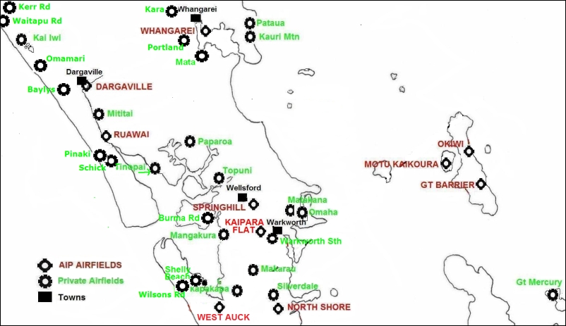
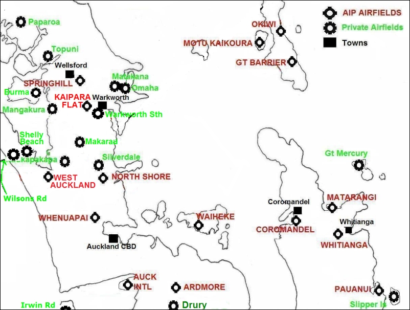
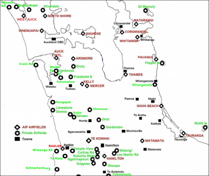
Airfields in the North: A to M
... There are around 100 airfields, (30 official 'AIP' listed airfields, and 70 known 'Private' airfields), within a short flying time of West Auckland. Details for each airfield are listed are below the maps.
Copyright waived: Aviation related websites / publications are welcome to add a link or copy from this page.
|
AIP Listed
Airfields: If there is anything unusual about the approach, the terrain effects or conditions of use, these will be noted on the AIP landing plate... click on 'NZxx' beside each AIP airfield below. The AIP airfields are generally approved for use by those hiring aircraft from the airport, though it always remains the pilot's decision as to whether a particular airfield is suitable for landing under the conditions at the time. |
Private
Airfields: Except in an emergency, 'Private' airstrips can only be used with the agreement of the airstrip owner, and flying school or hired aircraft need the owner's/instructor's approval to land at a private airstrip. However, it is worth finding and inspecting private strips from the air to know where they are in case of emergency. There are also hundreds of topdressing strips, which are not listed here unless they have a known G.A. connection or are particularly strategically located. |
Known
'walk to lunch' AIP listed airfields within easy flying time of West Auckland
are:
- Ardmore. AvCafé in Auckland Aero Club building to East of the
runway.
- Coromandel. The 'Mussel Kitchen' is an easy walk 400m up the road to the North, link below for hours.
- Great Barrier Island. Café in the Claris shopping centre 500m
to the west.
- Hamilton. Café in the passenger terminal.
- Kerikeri. Café in passenger terminal open near times of commercial
flights.
- Pauanui. Cafes in the shopping centre to the SW.
- Raglan. Cafes across the foot bridge in town to the east of the runway.
- Thames. Café in the Garden Centre across the road 200m south.
- Waiheke island. Cafés over the fence at the northern end of the runway
and 100m south
- Waihi Beach, Café on airfield at SE corner, normally open except
in mid winter.
- Whangarei. Café at passenger terminal.
- Whitianga. Café at airfield 7 days a week during summer,
Wednesday to Sunday during winter.
Far North
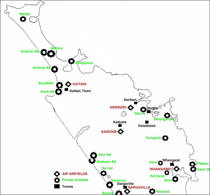
Mid North
East
South
Airstrip Rd Glider Strip: Private airstrip 118 miles NNW of West Auckland, near Ninety Mile Beach, 11 miles NW of Kaitaia Town at S34 56.69 E173 07.44. (view). Used as an emergency landing strip by gliders. Unconfirmed Google Earth measurement shows the strip as 520m long aligned 18/36 sloping up to the North at 80ft altitude. Find by aligning the Rangunu Harbour entrance with the northern end of the Karikari Peninsula.
----------------------------------------------------------------------------------
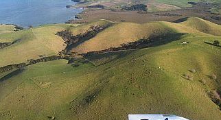
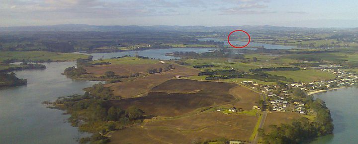
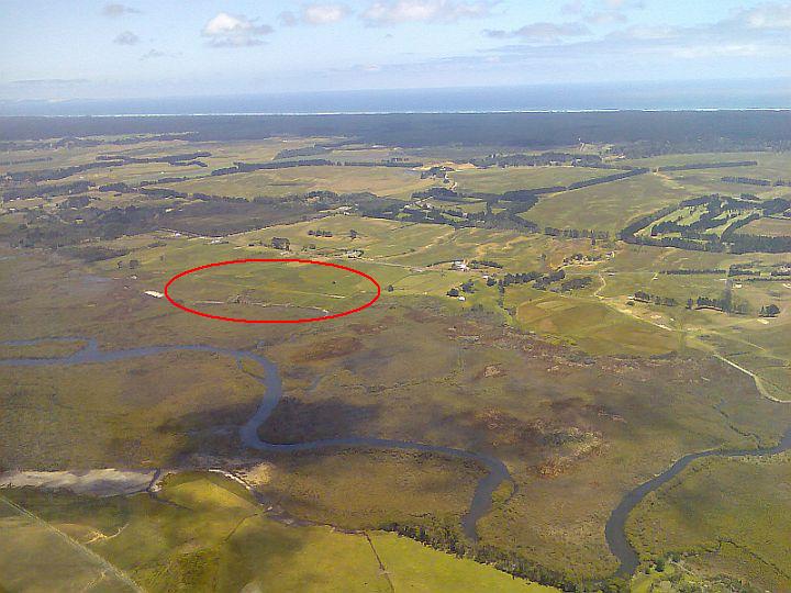
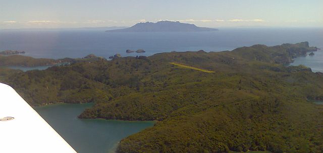
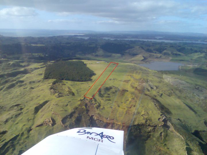
Arapaoa Rd Airstrip: Private airstrip 29 miles NW of West Auckland, on the Tinopai peninsula, a little to the south of Pahi on its own small peninsula at S36.18 E174.237. Unconfirmed Google Earth measurement shows the strip as around 450m, both ends rising at around 10% slope to a peak in the middle. The runways are aligned approx 04/22. Contact Tuhi Manukau 021 084 28922.
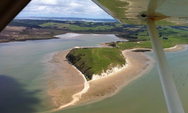
Looking to the NW on final for 04
----------------------------------------------------------------------------------
Ardmore Airport: AIP listed as NZAR. 35 miles SE of West Auckland at S37º 02' E174º 58' (view). Cafe at Auckland Aero Club building to the SE of the main runway on a small hill. All brands of Avgas are available. Ardmore is NZ's busiest airport and is close to controlled airspace for NZAA... so it is best to go in with an instructor the first time. Website: Ardmore Airport Ltd
On final for NZAR 03 [Panoramio photo]
----------------------------------------------------------------------------------
Arterial Rd Glider Strip: Private airstrip 127 miles NNW of West Auckland, near Ninety Mile Beach, 19 miles NW of Kaitaia Town at S34 49.55 E173 02.62. (view). Used as an emergency landing strip by gliders. Unconfirmed Google Earth measurement shows the strip as 680m long aligned 03/21 sloping up to the East at 65ft altitude. A narrow strip on one of the roads that leads inland from Ninety Mile Beach.
Surrounded by forest just back from Ninety Mile Beach. Locate the field by aligning Mt Camel on the Houhora Harbour with the northern end of the Karikari Peninsula.
----------------------------------------------------------------------------------
Auckland International Airport: AIP listed as NZAA. 27 miles south of West Auckland at S37º 00' E174º 47' (view). Auckland International is not a welcoming environment for light aircraft but it is worth remembering if you ever have a serious emergency while flying in the vicinity, as it has a very long and wide runway and excellent emergency services. Website: Auckland International Airport
----------------------------------------------------------------------------------
Baylys Glider Strip: Private airstrip 52 miles NW of West Auckland, five miles West of Dargaville, two miles east of Baylys Beach, at S35 57.21 E173 47.72. (view).
----------------------------------------------------------------------------------
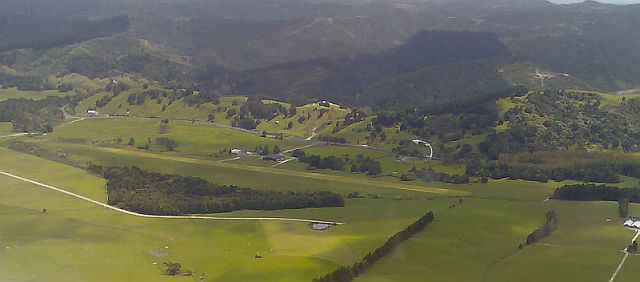
Burma Rd Airstrip: A long and wide private topdressing airstrip 16 miles north of West Auckland at S36º 22.67' E174º 22.92' (view). Topdressing strips are not normally listed here, but this is in the middle of an area often used for training flights from West Auckland. Unconfirmed Google Earth measurements show runway 05 as 640m long starting at 55 ft altitude and rising to 260 ft at the lime bin, a 10% slope, which makes it act more like a 1200m strip.
To the E of the lime bin there is also a 300m runway 24 starting at 140 ft and rising to 260ft, a 13% slope, but this has such variable slope (and would be affected by lee side turbulence in strong westerly winds) that the very long runway 05 would be the runway of choice even with a tail wind. Owner Mr. R. Cotton, Ph 09 422 1970.
Burma Rd Airstrips from the North. Moturemu Island lines up with the shoreline to the south and Burma Rd roadway is just off the bottom on this photo. [Chris Hoffmann photos]
Burma Rd 05 from the West |
Burma Rd 24 from the North |
----------------------------------------------------------------------------------
Clark Rd Glider Strip: Private airstrip 106 miles NNW of West Auckland, near the southern end of Ninety Mile Beach, five miles SW of Kaitaia Town at S35 07.22 E173 11.33. (view). Used as an emergency landing strip by gliders. At approx 120ft altitude.
Clark Rd airstrip from the east. Note the conspicuous motocross track just to the south of the strip.
----------------------------------------------------------------------------------
Christian Bay Ag Strip: Private airstrip on the northern coast of Kawau Bay. The strip looks quite usable but no details are known, and it is close to Omaha Flats which would be a better choice for emergency use if possible.
Christian Bay Agstrip, on the northen side of Kawau Bay. Cape Rodney and Leigh in the distance, Whangateau Harbour and Omaha off the photo to the left.
----------------------------------------------------------------------------------
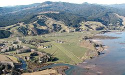
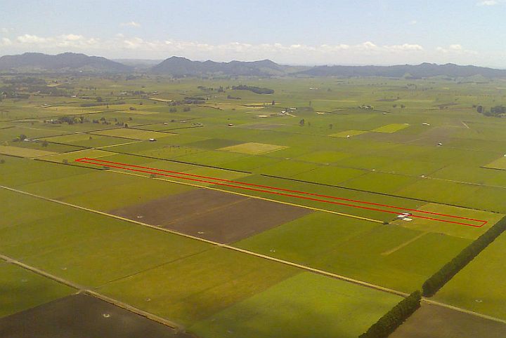
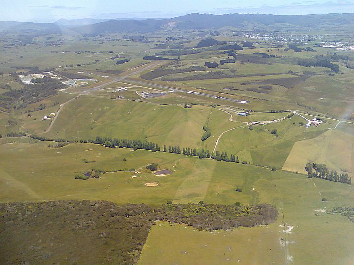
Collins Rd Airfield (Hamilton): (Status unknown Dec 2023). Private airfield 80 miles south of West Auckland at S37º 49.75' E175º 15.40' (view). All circuits to the north at 850ft altitude (700ft AGL), check the maps before use as it is under(or perhaps inside) Hamilton controlled airspace so current situational awareness and accurate navigation is necessary. Unconfirmed Google Earth measurements show the altitude as 160ft, and 720m of runway aligned 05/23. The airfield is home to the Waikato ML Club, Club House 07 970 1035, Website, Airfield contact Jan Reekers Ph 027 451 8544.
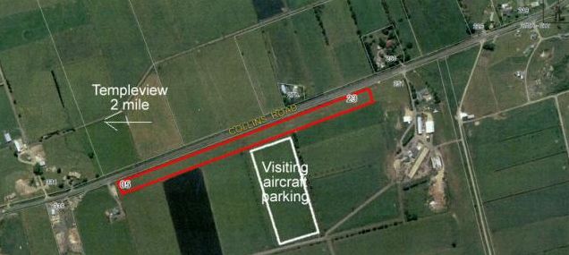
Collins Rd Airfield [WMLC photo]
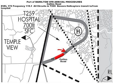
Before use check the Hospital transit zone is still current [WMLC info]
----------------------------------------------------------------------------------
Coromandel Airfield: AIP listed as NZCX. 53 miles east of West Auckland at S36º 47' E175º 30' (view), on the eastern shore of Coromandel Harbour, three miles south of Coromandel town. There is steep terrain to the East (see photo), so all takeoffs are on runway 30 towards the West. This makes it unsuitable to use in strong easterly winds as one would be landing in heavy turbulence and would have strong tail wind on takeoff. In normal conditions and Westerly winds, no problem. Website:Coromandel Flying Club
For lunch or a coffee, the 'Mussel Kitchen' a short walk North of the airfield on the main road sells large bowls of mussels in many varieties. It also has coffee and other food and coffee for mussel non enthusiasts. Check the opening hours as they vary according to seasons. Website http://www.musselkitchen.co.nz/
To have a meal in town, Coromandel Cabs Ph 07 866 8927, will take you into Coromandel town with its many cafes. if you have two hours to spare, it is well worth visiting the 'Driving Creek Railway and Potteries' a short walk to the NE of town. This has a 3km long mountain railway with switchback reversing turns, a horseshoe loop with a double deck bridge, tunnels and all the railway quirks as it climbs through native bush..
Coromandel Airfield, from South showing the airfield and town. The Mussel Kitchen Cafe is the white dot below the big white roofed building in the photo.
----------------------------------------------------------------------------------
Dargaville Airfield: AIP listed as NZDA. 50 miles north of West Auckland at S35º 56' E173º 53' view. The airfield is easy to find near the bridge, across the river from Dargaville town. Fuel available. A popular cross-country point for West Auckland students. Website: Dargaville Aero Club/Northern Wairoa Aero Club
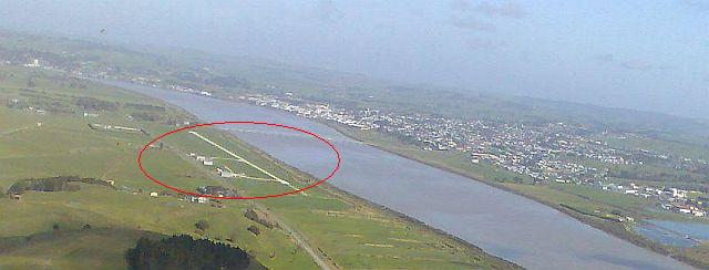
Dargaville Airfield from the East, on left base for runway 22 and about to turn final. The bridge and Dargaville town in the background.
----------------------------------------------------------------------------------
Drury Glider Airfield: Private airfield 38 miles SE of West Auckland at S37º 05.8' E174º 58.5' (view), four miles to the south of Ardmore. Do not fly over or too close to this airfield as the gliders have right of way, and while being winch launched to 1500ft or more have no forward visibility. They will be on radio 134.45 which is different from the local NZAR radio. The airfield is at 70ft altitude with 950m runway aligned 01/19, all circuits to the West. To comply with the glider field's resource consent, only powered planes with a towhook and gliders should visit. Website: Auckland Gliding Club
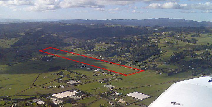
Drury Glider Airfield from the SW, Drury town and estuary off the left of the photo.
---------------------------------------------------------------------------------
Glenbrook Airfield: Private airfield 34 miles south of West Auckland at S37º 10' E174º 46.7' (view). Runway 04/22 is 540m at 15ft altitude, and easy to find up the estuary that runs East behind Clarkes Beach on the south side of the Manukau Harbour. The Bellinghams are always hospitable to visiting aviators, so this would be a handy escape for those approaching West Auckland from the south, unable to get past the West Coast Beach cliffs, and wanting to wait it out on the ground. Being at sea level this airfield should be accessible even in low cloud conditions. Contact Cliff Bellingham Ph 09 236 3851
Glenbrook airfield viewed from the East, on left base for runway 22. (Click for the view when approaching from West, taken from near Clarkes Beach village)
----------------------------------------------------------------------------------
Gordonton Airfield: Private airfield 71 miles south of West Auckland at S37º 37.1 E175º 17.7, five miles east of Taupiri Town. (view). The runway is reported as 680m long, with some undulations. Unconfirmed Google Earth measurements show the altitude at 85ft. The area frequency is 119.1, but the airfield itself works on 133.375. Home base of the Gordonton Microlight Club. Airfield contacts Martin Henton Ph 027 332 4415 or Donna Langman 07 824 6655
Gordonton Airfield from the East, looking West to the Huntly Gap.
----------------------------------------------------------------------------------
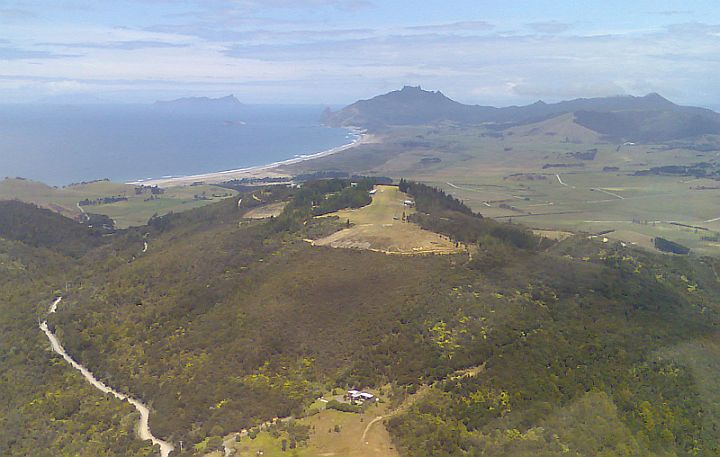
Great Barrier Airfield: AIP listed as NZGB. 56 miles NE of West Auckland at S36º 14' E175º 28' (view), at Claris town on Great Barrier island. Approaching from the West, look for Blind Bay approx two miles north of Tryphena Harbour, and the airfield will be found over the ridge from Blind Bay. A short walk leads to a good cafe in Claris village, and there is an excellent surf beach at the end of the cross runway, see photo below. A popular lunchtime destination for Auckland flyers. Landing fees are invoiced automatically. Website: Great Barrier Island, Great Barrier Airlines
Great Barrier Island, NZGB at Claris viewed from the east over the sea. Blind Bay on the west coast of the island is just over the low ridge to the centre left of the photo. The Mainland is in the distance under the line of cloud.
----------------------------------------------------------------------------------
Great Mercury Island Airfield: Private airfield 65 miles east of West Auckland at S36º 35.6' E175º 45.9' (view). On Great Mercury Island, off Mercury Bay and Whitianga. A one-way strip at the NW end of the island running up a hill on the western side of the small harbour. From unconfirmed Google Earth measurements the strip is 470m long and aligned 08/26 rising from 30ft at the East end to 200ft at the West, an 11% slope which would mean that all landings would have to be on 26 to the West, and all takeoffs on 08 to the East. Website: Great Mercury Island
Great Mercury Island Airstrip from the SW... an empty horizon as anyone flying this course will not make landfall for another 6500 nm (11,000km).
-------------------------------------------------------------------------------
Hamilton Airport: AIP listed as NZHN. 84 miles south of West Auckland at S37º 52' E175º 20' (view). Cafe at terminal on the eastern side of the main runway, ask the tower if you wish to park on the east, when it is usually possible to exit (and re-enter) the security fence through the Fire Station. Aero Club hospitality at the Clubrooms on the western side near the tower. Fuel is available at the Club. There are many runways and the airfield is in flat country, which can be confusing for anyone unfamiliar with the area. For an easy approach, come in from the east and hold at Cambridge, or from the west and hold at Temple View, to get joining instructions from the tower. It also reduces the workload to ask for a specific runway. Website: Hamilton Airport
---------------------------------------------------------------------------------
Hansen's Airfield: Private airfield 61 miles south of West Auckland at S37º 32.1' E174º 59.03', eight miles west of Huntly Town. (view). Used by the Matira Flying Club. Unconfirmed Google Earth measurements show the runway as 450m long, with the runway aligned 15/33, with the northern end at 180ft altitude rising to 240ft at the southern, a 4% slope, which would make it a one way strip in most wind conditions with all landings to the South on 33 and takeoffs to the North on 15. Contact Michael Hansen 09 233 3175.
----------------------------------------------------------------------------------
Harbour Rd (Kawhia) Glider Strip: Private airstrip 88 miles south of West Auckland and just off the bottom of the 'South' map above. 17 miles south of Raglan, at the eastern end of the Kawhia Harbour, at S38 05.65 E174 56.04. (view). Used as an emergency landing strip by gliders. Unconfirmed Google Earth measurement shows the strip as 50m rising steeply to the East, then 300m reasonably level along the top of a ridge at 250ft altitude aligned 06/26.
----------------------------------------------------------------------------------
Hauhora Airfield: (Syd's International). Status doubtful Dec 2023. Private airfield 124 miles NW of West Auckland at S34 46.48 E173 05.71 (view) , on the Hauhora Harbour. To find it follow the harbour to the north and when it finishes with mangroves, the airfield will be found along the western shoreline. From unconfirmed Google Earth measurements, the airfield appears to be approx 500m long at 6ft altitude, with runways 12/30. Owner, Syd Udjar.
Hauhora Airfield from the northern end of the Hauhora Harbour.
----------------------------------------------------------------------------------
Irwin Rd (Awhitu Peninsula) Glider Strip: Private airstrip 26 miles south of West Auckland, three miles south of the Manukau heads on Awhitu Peninsula at S37 05.55 E174 33.895. (view). Used as an emergency landing strip by gliders. Unconfirmed Google Earth measurement shows the strip as 400m long aligned 05/23 at 550ft altitude.
Irwin Rd Glider Strip looking north to the Manukau Harbour entrance. An easy to find airstrip in an isolated area, and potentially a useful escape for an aircraft unable to get past the West Coast beach cliffs back to West Auckland.
----------------------------------------------------------------------------------
Kai Iwi Airfield: Private airfield 63 miles north of West Auckland at S35º 47.64' E173º 37.7' (view), just to the north of the larger Kai Iwi lakes, 13 miles NW of Dargaville on the coast. From unconfirmed Google Earth measurements the strip appears to be approx 500m long sloping up to the North East from 300ft altitude to 400ft with an average slope of 4% but some parts steeper. Except in strong Westerly winds, this would make it a one way strip with landings uphill on 02 to the NE and takeoffs downhill on 20 to the SW. Contact: Peter Flood. Ph 09 439 2994
Kai Iwi Lakes airfield
----------------------------------------------------------------------------------
Kaikohe Airfield: AIP listed as NZKO. 78 miles north of West Auckland at S35º 27' E173º 49' (view), three miles south of Kaikohe town. The 2 short runways are often unusable due to sheep or hay, so expect to use the long runway. Info about Kaikohe Gliding Club
Kaikohe Airfield [Northland Gliding Club photo]
----------------------------------------------------------------------------------
Kaikoura Island, Great Barrier Island: AIP listed as NZKD. 53 miles to the NE of West Auckland at S36º 11' E175º 19' (view). An airfield in an unexpected positon along the ridge of a heavily wooded and steep island. Walk down through the bush to a swimming beach. This is conservation land so don't take dogs (or cats or rats) and special conditions apply, see AIP. Website: Kaikoura Island
Kaikoura Island Airfield from the East. The grass strip is along the ridge on the island that forms the outside of Port Fitzroy on Great Barrier Island. Little Barrier Island is in the background in this photo with the mainland in the far distance.
----------------------------------------------------------------------------------
Kaipara Flats Airfield: AIP listed as NZKF. 16 miles north of West Auckland at S36º 24' E174º 35' (view), three miles west of Warkworth town. To find it look for the large glasshouses two miles west of Warkworth, these are under left base for runway 25. A popular cross country destination for West Auckland students. Website: Rodney Aero Club
Kaipara Flats airfield from the SE, on late downwind 25 left hand.
----------------------------------------------------------------------------------
Kaitaia Airport: AIP listed as NZKT. 109 miles north west of West Auckland at S35º 04' E173º 17' (view), three miles NE of Kaitaia town. Avgas may be available, check availability and card type before relying on this. The northernmost fueling point for those with a BP fuelcard is Kerikeri 33 miles to the SE. Runway 12/30 at Kaitaia is long and smooth, but 18/36 is poorly maintained and best avoided. Do not use the grass aligned 06/24 which looks like a runway but is no longer part of the airfield. Websites: Kaitaia Aero Club
Kaitaia Airport from the NW, on early left base for runway 12. Kaitaia town is in the middle distance.
----------------------------------------------------------------------------------
Kara Airfield: Private airfield 53 miles north of West Auckland, seven miles west of Whangarei Airport near Maungatapere at S35º 44.2' E174º 12.95' (view) , The strip is 350m long, 300m usable aligned 08/26, at 700ft altitude. Preferred approach is 08. Contact Allan Jessop Ph 09 4346232.
Kara Airstrip from the West, looking down runway 08 with Whangarei town visible in the distance. . As the airfield is on the SW slope of Maunu Mountain, airflow disturbance is to be expected in NE conditions.
----------------------------------------------------------------------------------
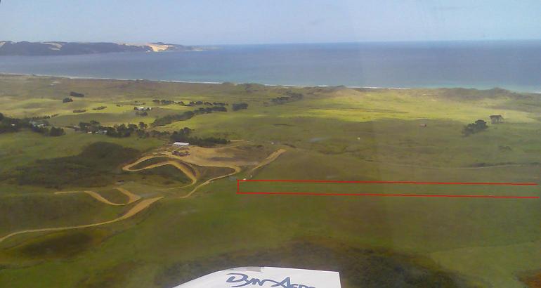
Kariotahi North: Topdressing strip 33 miles south of West Auckland at S37 11.59 E174 37.11 (view), nine miles S of the Manukau Entrance and five miles North of Kariotahi. Handily placed for those caught out on the West Coast with Lake Pokorua nearby for identification. Unconfirmed Google Earth measurements show the runway as 550m long, with the runway aligned 05/23, at 530 ft altitude with a 2% slope up to the West. Contact and street address unknown.
Airstrip runs between the coast and Lake Pokorua, with Clarkes Beach town in the background.
----------------------------------------------------------------------------------
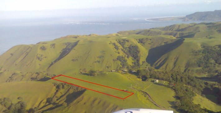
Kauri Mountain Airfield: Private airfield 50 miles north of West Auckland, at S35º 46.4' E174º 31.9' (view), between Whangarei Heads and Pataua. This is a one way strip with landings uphill to the South on runway 14 and takeoffs downhill to the North on runway 32. Unconfirmed Google Earth measurement shows the strip as 350m long sloping up at 4%. Contact owners, Bob and Ann Syron ph 09 366 6843 or 0274 737 914.
Kauri Mountain airfield from the NW, on mid final runway 14 with Bream Head, 'The Hen' and Ocean Beach in the background
----------------------------------------------------------------------------------
Kerikeri Airport: AIP listed as NZKK. 88 miles north of West Auckland at S35º 16' E173º 55' (view), near Kerikeri town. For a large airport it can be surprisingly difficult to find, an easy way to find it is to go to Lake Omapere and steer 030M towards Kerikeri town, the airfield is half way between the lake and the town. NZKK is the commercial airport for the Bay of Islands and has a cafe where visiting aviators can get lunch or a coffee around the times of commercial flights.
NZKK is the usual place for light aircraft to clear customs to arrive/depart for Norfolk Island, Lord Howe Island or Australia. BP avgas is available on the SE side of the grass cross runway (extreme right of the photo), and Zed avgas by the air terminal. This is the most northerly airfield in NZ with BP avgas. Zed avgas, but not customs clearance unless specifically arranged, is also available at Kaitaia 33 miles to the NW. Websites: Bay of Islands Aero Club, Bay of Islands / Kerikeri Airport
Kerikeri Airport, Sealed and grass runways, looking North up runway 33, Kerikeri town to the upper right.
----------------------------------------------------------------------------------
Kerr Rd Glider Strip: Private airstrip 70 miles NW of West Auckland, 20 miles north of Dargaville and two miles NNE of Manganui Bluff on the west coast, on a ridge leading NE from the bluff at S35 43.17 E173 34.44. (view). Used as an emergency landing strip by gliders. Slopes up to the SW.
Kerr Rd strip slopes up to the SW, and should be usable in westerly winds when Waitapu Rd strip is affected by Lee turbulence from the Mangonui Bluff, which is at the top right corner of the above photo.
----------------------------------------------------------------------------------
Krippener's 'Jeep Base' Airfield: Private airfield 85 miles south of West Auckland at S37º 55.2' E175º 12.5', eight miles SW of Hamilton Airport. (view). Unconfirmed Google Earth measurements show the runway as 610m long, with the runway aligned 04/22, rising from 130ft altitude at the eastern end to 170ft at the western end, a average slope of 2%. Airfield contact Ivan Krippner 021 274 1908. Email [email protected]. Classic Cubs Classic Cubs

Krippner's Airfield (Henwood photo)
----------------------------------------------------------------------------------
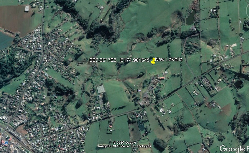
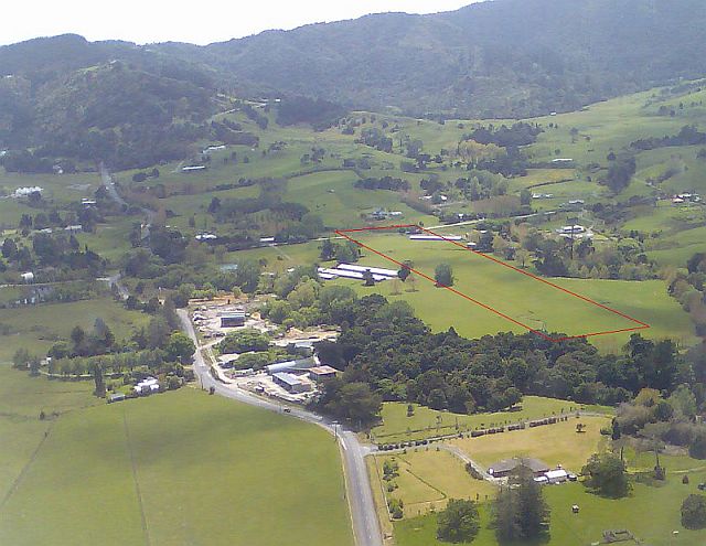
LaValla Estate Airfield (Tuakau):
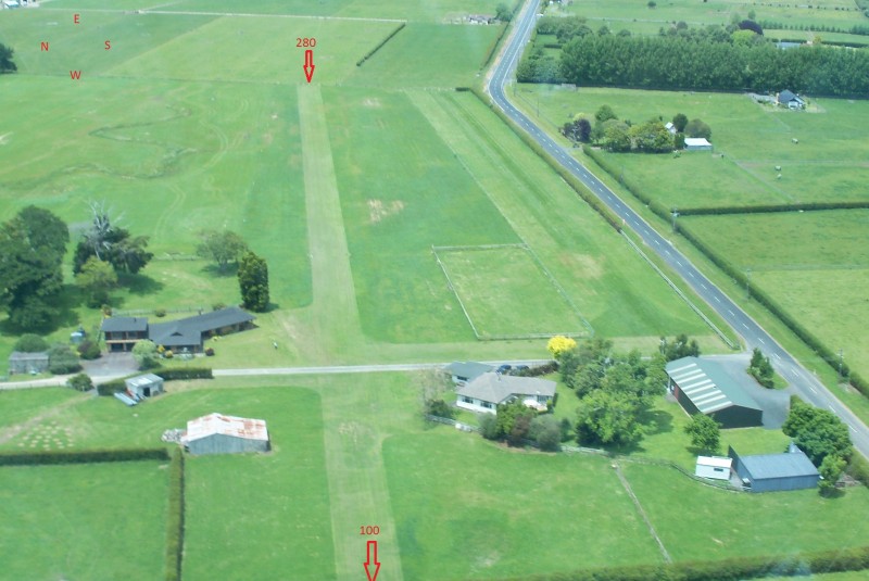
Private airfield 45 miles south east of West Auckland Airport at S37.251762 E174.961545, near Tuakau. The runway was moved and realigned in 2020, so do not rely on memory and go to the old runway. Unconfirmed Google Earth measurements show the runway as 515m long, with the runway aligned 08/24, rising from 130ft altitude at the western end to 220ft at the eastern end, an average slope of 5%. 95 Octane fuel can be arranged and a courtesy car is available for aviators. LaValla Estate has very nice accomodation and breakfast can be purchased. Sundays have 'lunches with a difference' and live music. Tuakau has Cafes, Antique shop and Museum. Safety note: Beware of a large pine tree 200 metres prior to landing vector 08 and beware of private power line 100 metres prior to landing vector 24.
LaValla airfield from August 2020
Contacts: Peter Jackson 021 610 375 with secondary number Shaun 021 733 059
Email [email protected]
---------------------------------------------------------------------------------
Lee Martin Road Airfield: Private airfield 85 miles south of West Auckland at S37º 49.9', E175º 24.65', four miles NE of Hamilton Airport and inside the HN control zone. (view). Talk to HN Control and ask for clearance to enter the zone to use 'Lee Martin Rd airstrip'. Runway 10/28 is 450m at 200ft. Caution, Power lines to the North, South and West. Best approach from the East. Runway can be damp in Winter. Note that the old runway close to the road is no longer in use. Contacts: Anton Meyer 021 2895999, Jacky 021 2895994, Email [email protected] Website with runway details http://aerosport.co.nz/Our_Runway.html.
Lee Martin Road Airfield, on final for runway 10. (Aerosport Aviation photo)
----------------------------------------------------------------------------------
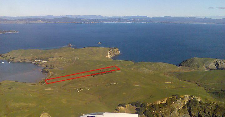
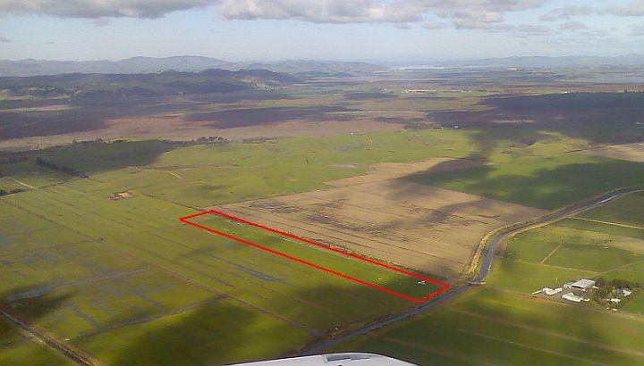
Limestone Downs Airfield: Formerly AIP listed, a private airfield 57 miles south of West Auckland at S37º 28.8' E174º 45.1', five miles south of Port Waikato town, and one mile inland of the coast on the top of a plateau. (view). There are two runways, the short grass one is too short for anything much bigger than a 'rag and tube' trike microlight and only the long limestone runway is usable. From unconfirmed Google Earth measurements the airfield is at 600ft altitude with the white limestone runway 470m long aligned 01/19.
Limestone Downs airfield approaching from the North on the coast. Note the offshore rocks off the point on the RHS of the photo (and there is a small island further offshore of these), which are a good pointer as Limestone Downs is inland on a ridge approx one mile north of these.
----------------------------------------------------------------------------------
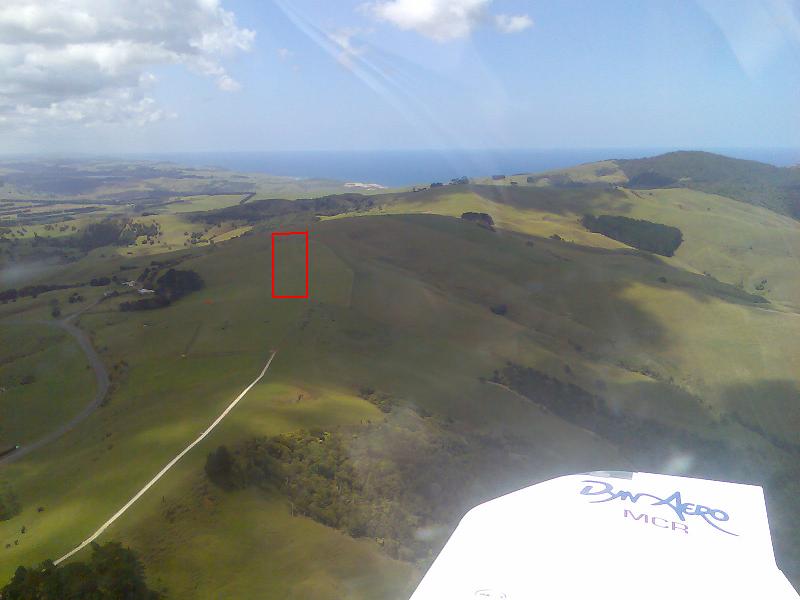
Makarau Airfield: Private airfield 10 miles NE of West Auckland at S36º 31.6' E174º 32.0' (view). Check current status before use as may be part of an active off-road bike track. A good sized airstrip that is easy to use but can be difficult to find. From the south follow the railway line until it goes to the east for several miles then when it makes a large turn to the north you're on left base 24 but the airfield which won't be visible until late base. From the north, follow the railway line south from Kaipara Flats town until it goes through tunnels tracking south, then swings to the west in a wide curve, with the airstrip one mile inside this curve. From unconfirmed Google Earth measurements, the field appears to be 600m long at 390ft altitude, with runways 06/24. Contact Rex Swensson Ph 09 420 4101
Makarau Airfield from the North, mid downwind runway 06 left hand. [Brian Millett photo]
----------------------------------------------------------------------------------
Mangakura Airstrip: Private airstrip 14 miles north of West Auckland at S36º 25.4' E174º 25.9' (view). To find the airstrip line up Moturemu Island with the South Head of the Kaipara harbour and look for it immediately to the south of the Hoteo River entrance. A useful emergency strip in an area often used for training from West Auckland. From unconfirmed Google Earth measurements the strip appears to be 550m long at 6ft altitude, 350m maintained and a rough extension, with runways 05/23.
Mangakura Airstrip from the East, on long final for runway 23. To the left is the mouth of the Hoteo River, 14 miles north of West Auckland.
----------------------------------------------------------------------------------
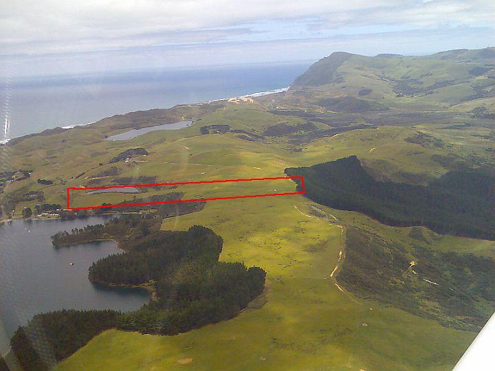
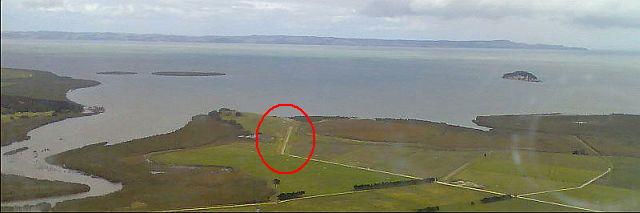
Mata Airstrip: Private airstrip 47 miles north of West Auckland, 5 miles south of Whangarei Airport near Springfield radio beacon, at S35º 51.6' E174º 21.03'. (view). Runway of 700m aligned 06/24 at 100 ft altitude. Approaching 24 an angled base leg along the western side of the power pylons avoids the need to pass low over them. Contact Leo Johns, ph 027 492 8416.
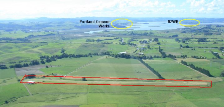
Mata airstrip looking North, with Portland Cement works and Whangarei Airport in the background. Overhead Mata, the shipping port wharves (behind the 'NZWR' lettering in the above photo) are just to the left of the Airport on its hill.
----------------------------------------------------------------------------------
Matakana Airfield: Private airfield 23 miles NE of West Auckland
at S36º 20.1' E174º 42.3', (view),
two miles north of Matakana town. The strip is 520m when the fences are
rolled back, at 110ft altitude, aligned 14/32. To find it, follow the
road north from Matakana town and the strip is on the RHS parallel with
the road near three long sheds.
There are tall trees on approach at both ends of the strip which can create
severe wind shear and turbulance and usually two roll up fences across
the strip leaving only about 300m clear in the middle. Contact Brian Leach
ph 09 422 7418.
Matakana Airfield from the South, flying up the road from Matakana Town.
----------------------------------------------------------------------------------
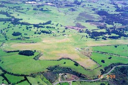
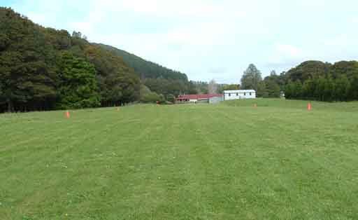
Matamata Airfield: AIP listed as NZMA. 92 miles south of West Auckland at S37º 44' E175º 45', five miles north of Matamata town (view). Matamata has an active glider club. To find it, follow the railway north from Matamata town, until the railway branches with one line going to the east and the other continuing north, and one mile after this the airfield is near the point where the road and rail split. There are two runways but usually only the one parallel with the road is open. Websites: Matamata Aero Club, Piako Gliding Club
----------------------------------------------------------------------------------
Matangi Airfield: Private airfield 85 miles south of West Auckland at S37º 48.5' E175º 25.5' (view), five miles NE of Hamilton airfield and inside NZHN controlled airspace. From unconfirmed Google Earth measurements the field is at 200ft altitude with a 600m runway aligned 13/31. Contact Ivan Strathern Ph 07 829 5756 or 027 594 3328.
----------------------------------------------------------------------------------
Mercer Airfield: AIP listed as NZME. 49 miles SE of West Auckland at S37º 16' E175º 07' (view). Mercer has its own radio frequency and MBZ area.
Mercer Airfield from the NE, with Meremere and the Waitako river in the background. To locate the field, look for the stream with a bridge leading to the hangars.
----------------------------------------------------------------------------------
Mititai Airfield: Private airfield 44 miles north of West Auckland at S36º 01.7' E173º 56.5' (view), directly across the Wairoa river from Te Kopuru town at 6ft altitude. Status doubtful Dec 2023. From unconfirmed Google Earth measurements, the airfield appears to have a strip 07/25 of 300m, and 15/33 of 210m. Contact owner, Ian Godfrey. Ph 09 4397569 or 025 2679130
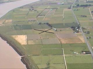
Mititai Airfield from the South [Brian Millett photo]
----------------------------------------------------------------------------------